
Huntington Beach ZIP Coverage
The official Huntington Beach ZIP polygon layer lists exactly five values: 90742, 92646, 92647, 92648, and 92649. Those polygons define the city GIS view, not a list of residents. They are useful for setting an area boundary before a researcher moves to address points, parcels, tax records, or a historical source.
Each ZIP has a different local shape. Southern and southeastern neighborhoods sit in 92646, north-central and inland areas use 92647, the downtown and civic coast is centered in 92648, and northern communities such as Huntington Harbour and Bolsa Chica are in 92649. Sunset Beach carries 90742 in the city layer, preserving a postal identity that does not look like the four 9264x codes.
| ZIP Code | Areas Covered | Post Office | Notes |
|---|---|---|---|
| 92646 | Southern and southeastern Huntington Beach, with postwar tracts near Fountain Valley, Costa Mesa, and Newport Beach | USPS delivery ZIP; a single station for all deliveries was not verified | Postal coverage approaches neighboring cities, so verify the parcel jurisdiction |
| 92647 | North-central and inland areas around Warner, Goldenwest, Edinger, and Beach corridors | Huntington Beach Post Office, 6771 Warner Avenue, Huntington Beach, CA 92647-9998, (714) 843-4200 | The postal result alone does not prove the parcel is inside the city line |
| 92648 | Downtown, coastal central Huntington Beach, and the civic and library area | Central Library, 7111 Talbert Avenue, uses 92648; a single station for all deliveries was not verified | City Hall and the Central Library are useful local reference points |
| 92649 | Northern Huntington Beach, Huntington Harbour, Bolsa Chica-area communities, and the Heil Avenue area | A single USPS station serving all 92649 routes was not verified | Harbour and city-edge parcels make street sequence less reliable |
| 90742 | Sunset Beach postal area on the northwestern coast | Sunset Beach postal service; current station details were not verified | Municipal Huntington Beach and postal Sunset Beach coexist after annexation |
No local ZIP split or realignment has been verified in the research, and no unique or PO-box-only Huntington Beach ZIP was confirmed. Surfside is a separate warning: 90743 is common in USPS addressing and appears as a municipality value in the city address layer, but it is absent from the five-value city ZIP polygon domain.
Huntington Beach ZIP Directory Areas
92648 is the most useful starting point for civic and historical research because Huntington Beach City Hall is at 2000 Main Street and Huntington Beach Central Library is at 7111 Talbert Avenue. The Orange County California Genealogical Society collection is on the library's lower level, and the collection includes directories, census material, maps, periodicals, and family histories. A ZIP code points toward that civic area, but the library catalog and local staff determine which historical volume is actually available.
92646 also matters for local research because the FamilySearch center at 8702 Atlanta Avenue uses that ZIP. The center at 5402 Heil Avenue uses 92649. Both are public centers with trained help and access to partner collections that may be restricted from a home connection, making ZIP geography useful when planning a records visit without treating a ZIP as a person index.
The USPS listing for the Huntington Beach Post Office provides the verified 92647 station details that anchor the coverage table above.
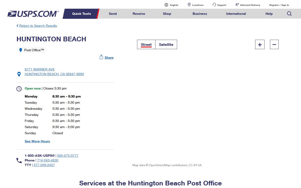
The post-office record helps confirm a delivery channel, while the city GIS boundary and parcel layers answer the separate jurisdiction question.
Huntington Beach ZIP Lookup Steps
A ZIP code directory search needs a different tool at each stage. The city Property layer defines the polygon, the WebAddresses layer finds address points within a ZIP, and county systems take over only after an address or APN is known. None of those steps creates a ZIP-wide list of people.
- Verify the exact deliverable address with USPS By Address. Save the five-digit ZIP and ZIP+4, but keep in mind that ZIP+4 is a delivery code, not a parcel identifier.
- Query the city WebAddresses layer on ZipCode or ZIP4 and retain address components, APN, MUN, condo status, and coordinates where populated. The service has a maximum of 1,000 records per response, so paginate larger queries.
- Use the ZIP polygon layer to confirm the area, then use its Query, statistics, ordering, distinct-value, pagination, or distance functions when a direct GIS query is needed. A result is a polygon or address feature, not a resident record.
- Move a selected APN to the Orange County Assessor, Treasurer-Tax Collector, or land-records map. The county-hosted value screen is APN-only and does not display an owner name online.
- Treat voter information as a separate protected channel. The authenticated voter tool checks a person's own registration, while a county voter-file request requires an approved purpose, original signature, identification, and security explanation.
Once a ZIP narrows the area, the Huntington Beach by-address directory is the natural next step for street-level parcel and permit work. That handoff keeps a ZIP from being mistaken for a household list.
Note: A ZIP search can locate address infrastructure, but it cannot by itself establish ownership, occupancy, or a current resident.
Huntington Beach ZIP Verification
The USPS ZIP Code Lookup offers By Address, By City and State, and Cities by ZIP Code modes. By Address is the right choice for a parcel question because it returns the ZIP+4 for a deliverable address. By City and State is useful for a broad postal list, while Cities by ZIP Code shows the postal places associated with a code.
The form does not return an APN, legal description, parcel boundary, or resident identity. Its answer describes mail routing. That distinction matters around Huntington Beach, where postal city, municipality, and parcel situs can diverge. Keep the USPS result as one dated fact, then compare it with the city address layer before selecting a county record.
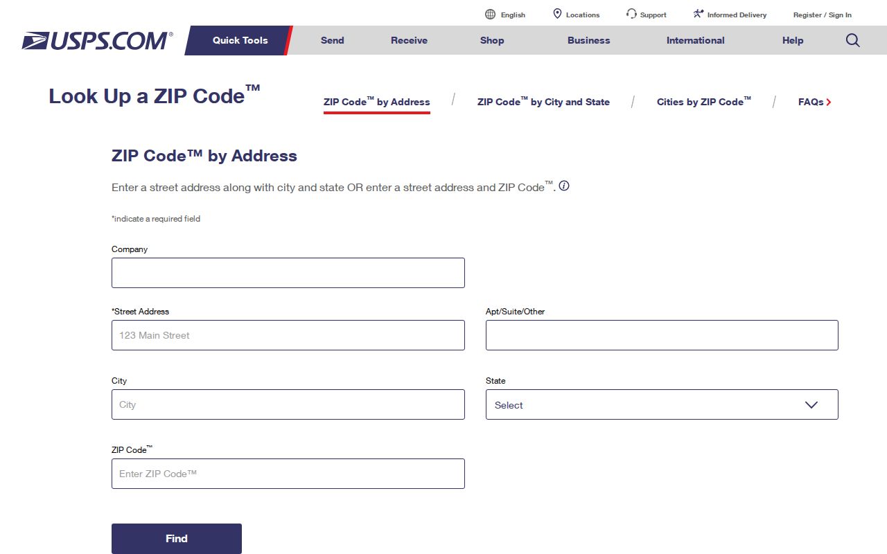
The USPS lookup image shows the address-first choice that should precede any attempt to count or filter local address points.
Huntington Beach GIS ZIP Fields
The city ZIP layer is a small, inspectable dataset rather than a consumer directory. Its fields explain what a ZIP query can actually return. The ZIP layer query endpoint supports advanced queries, statistics, ordering, distinct values, pagination, SQL expressions, and distance queries, with a maximum response count of 1,000.
| Field | What the ZIP layer returns |
|---|---|
| OBJECTID | System row identifier for a polygon feature |
| ZipCode | Coded string limited to 90742, 92646, 92647, 92648, or 92649 |
| Acres | Polygon area in acres |
| SqMi | Polygon area in square miles |
| Shape | ZIP polygon geometry |
| GlobalID | Persistent feature identifier |
For address-level work, the companion WebAddresses layer adds ZipCode and ZIP4 to street components, APN, municipality, address type, mailing flag, condo indicator, and coordinates. It supports Query and pagination. Because its output is address infrastructure, an address point must still be joined to a parcel and then to the proper custodian.
Note: The GIS service maximum is a response limit, not a count of Huntington Beach residents or households within any ZIP.
Huntington Beach ZIP Code City Limits
Postal boundaries route mail; they do not define incorporation. 92647 includes the principal Huntington Beach Post Office, yet a postal Huntington Beach result is not proof that a parcel lies inside the city. The reverse problem appears at the coast: Sunset Beach retained 90742 after Huntington Beach annexed the community on August 22, 2011. The city ZIP layer therefore carries a non-926 code inside a municipal Huntington Beach area.
Surfside shows why a current address deserves an exact check. The city address schema accepts Surfside as a municipality value and USPS commonly uses 90743, but 90743 is not one of the five ZIP values in the city Property polygon domain. Do not silently add 90743 to the city coverage table. Verify the deliverable address with USPS, then inspect the municipal and parcel layers.
- ZIP code
- A five-digit USPS delivery area used to route mail. It is broader than a parcel and can cross a city boundary.
- ZIP+4
- A four-digit extension that narrows delivery routing for an address or group of addresses. It is not a legal land description.
- PO-box ZIP
- A ZIP used for post-office box delivery or another limited postal pattern. No Huntington Beach-specific PO-box-only ZIP was verified.
- Unique ZIP
- A code assigned to one institution or organization rather than a broad neighborhood. No local unique ZIP was verified.
- Carrier route
- An operational delivery route inside a postal area. It is finer than a ZIP and does not identify residents.
Note: A city boundary query and a USPS address query answer different questions, so both should be preserved in a careful local record.
Huntington Beach Postal Identity
Sunset Beach is the clearest Huntington Beach example of postal and municipal geography separating. The community's approximately 134 acres were annexed on August 22, 2011, while 90742 remained visible in the city's ZIP polygon layer. A historical source may therefore use Sunset Beach, a county jurisdiction, or Huntington Beach for the same modern area, depending on the record date and record keeper.
City address points also distinguish Huntington Beach, Sunset Beach, and Surfside in the MUN field. That coded value is more precise than a postal city label for jurisdiction research, but it still does not replace the parcel boundary. Around Huntington Harbour, canals and islands add another spatial complication: the nearest parcel is not always the next house number.
Geography check. Treat postal city, municipal jurisdiction, and parcel situs as three separate fields. Their differences explain many apparent ZIP or address mismatches in Huntington Beach.
Huntington Beach Address Layers
The Orange County Land Records GIS gateway provides the county-side bridge after a ZIP has been verified. Its tools include Find Address, Find Intersection, Select on Map, Identify, Advanced Search, thematic maps, bookmarks, Community Information, Street View, drawing, measurement, export, print, and map links. The county map can show parcels, assessor maps, tract and parcel maps, surveys, annexations, and other spatial context.
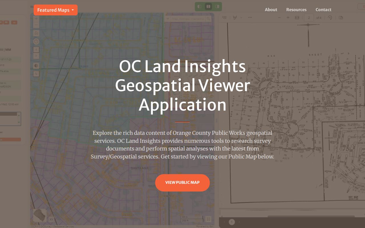
The county land-records view is a place-finding tool. Exported data are clipped to the current extent, and the map identifies geography rather than occupancy. Use the selected parcel to carry an APN, tract or legal description into assessment, tax, permit, or recorded-document research.
For a historical address, the Annexation Areas layer can show when a local area entered city jurisdiction. That matters when an older record was created by a county or rural custodian instead of a Huntington Beach department. ZIP evidence starts the search, but legal description and APN keep it on the same land.
Huntington Beach ZIP Directory Limits
A ZIP code directory should be read as a routing index, not a current-resident export. The recorder's Grantor/Grantee engine is party-indexed and does not browse by ZIP. The Orange County Assessor secured-value screen asks for an eight-digit APN and omits owner names from web results. The Orange County voter tool authenticates the voter rather than opening a name, street, or ZIP browse.
| Tool | Useful output | What it does not prove |
|---|---|---|
| USPS By Address | Delivery ZIP and ZIP+4 | Parcel identity, municipal jurisdiction, or resident identity |
| City WebAddresses | Street components, ZIP, ZIP+4, APN where populated, and MUN | Ownership, household composition, or current presence |
| RecorderWorks | Indexed parties and recorded instruments by name and date, generally from 1982 forward | A ZIP-wide list or proof that an indexed party occupied the address |
That limit is useful rather than frustrating. It tells a researcher when to stop broadening a ZIP query and switch to a precise address, APN, legal description, or record-specific request. It also prevents a city polygon from being presented as a people directory.
Myth check. A public ZIP layer does not mean every field connected to the ZIP is public. Address, ownership, voter, court, and protected-address rules remain separate.
A Careful Huntington Beach ZIP Search
For property context, the Orange County Treasurer-Tax Collector search can use a physical property address, parcel number, tax-lien number, or other listed property keys. The county's redesigned tax page offers up to 15 years of bill copies and two years of payment detail. Those bills can establish situs, owner-of-record information on the lien date, levy, and payment status, but a tax record is not an occupancy roll.
If a selected address fails to resolve, keep the USPS result, city MUN value, APN, and legal description together. Then compare the city boundary, annexation, parcel, and permit records. For an identifiable existing city or county record that is not posted, the California Public Records Act, Government Code sections 7920.000 through 7931.000, provides a request route, but it does not require a custodian to create a new ZIP-wide resident list.
ZIP geography is most reliable when it narrows a question and then steps aside. A verified postal code can point toward the right map, post office, library, or county system. The parcel and the record's date decide what the resulting name, owner, occupant, or historical fact actually means.