
Huntington Beach Neighbors Sources
A block lookup is a sequence of public records, not one universal neighbor directory. City GIS establishes which parcels touch an address. County assessment and tax systems add parcel facts, while RecorderWorks adds recorded parties over time. Directories and census pages can show listed households for older dates, and permits can date changes without proving who was present.
The coverage table separates those roles. It also shows why a ZIP polygon, HOA layer, or voter tool cannot be treated as a complete list of Huntington Beach neighbors.
| Source | What It Shows About a Block | Access |
|---|---|---|
| City parcels and address points | Parcel geometry, street and unit fields, APN where populated, ZIP, municipality, and adjacency | Free city ArcGIS services; direct responses are limited to 1,000 records |
| Property thematic map | ZIP, HOA, annexation, land-record, and city-property overlays | Free map layers; spatial context, not a household list |
| County assessment and tax roll | Parcel assessment facts and mailing-versus-situs clues | Official county channels; some owner fields are suppressed online |
| Clerk-Recorder index | Recorded owners and parties over time | Free party index; document images are not supplied online |
| Reverse directories | Listed subscribers or occupants in street-number order | Library and archive access varies by year; omissions are common |
| Census through 1950 | Residents and household relationships on an enumeration page | National Archives access; 1960 remains closed until 2032 |
| Voter data | Registration or status through authenticated or approved uses | Not an anonymous public neighbor browser |
| Building permits | Construction, dates, applicants, contractors, and site evidence where public | Address or APN search; keep each named role intact |
Use the map to learn which parcels are adjacent, then query each APN separately. A recorded owner, listed subscriber, permit applicant, and actual neighbor may be different people attached to one place.
One Parcel Starts Huntington Beach Neighbors
The city workflow begins with an exact address point. The Huntington Beach WebAddresses layer can preserve the street number, fractional component, unit, ZIP, ZIP+4, APN where populated, municipality, address type, mailing flag, condominium indicator, and coordinates. Those fields identify the place that should be compared with surrounding parcels.
The useful process is simple: address point → target parcel → neighboring APNs → county assessment or tax context → recorded-party checks → historical directory or census comparison. This order gives Huntington Beach neighbors a parcel-based starting point and prevents a name from being attached to the wrong lot before the block shape is understood.
For a full named-street chain, use the Huntington Beach by-address directory after the immediate block is known. Neighbor research should stay spatial and parcel-specific.
Map Adjacent Huntington Beach Parcels
The Huntington Beach Property map service is the central block tool. Its layers include Buildings, Parks, Annexation Areas, Land Records, City Owned Property, Zip Codes, HOAs, rights-of-way, wharfs, and beaches. The basemap supplies parcels, streets, alleys, city boundaries, civic buildings, and schools.
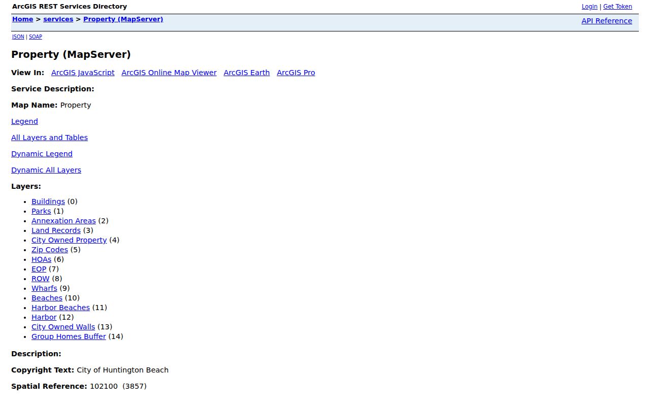
The map image shows why a block is a geometry problem first. Parcels can face a cross street, canal, alley, or open edge, and the closest polygon may not carry the next sequential house number.
- Search or zoom to the target address in the city property or basemap viewer.
- Turn on Parcels, Buildings, Land Records, HOAs, Zip Codes, Annexation Areas, and City Boundary as needed.
- Use Identify or Find on the target parcel, then click each adjacent polygon, including across the street or canal.
- Record neighboring APNs in physical order. The service does not advertise a dedicated radius or buffer button.
- Look up each APN through the county assessment or tax channel. Never copy the target parcel's mailing address onto a neighboring situs.
- For a complete face block, map-browse and paginate direct queries when needed. The city service has a 1,000-record maximum per response.
The result is an auditable APN list. Names come later, and only from the record system that actually holds them.
Huntington Beach Neighbor Address Fields
The WebAddresses REST layer is more precise than a consumer street list. It supports Query and pagination, but the public-facing viewer's exact button labels and autocomplete rules were not exposed in the inspected REST metadata. A direct query should therefore preserve raw field values instead of silently normalizing them.
- Address_Num, Fraction, Unit, Bldg_Num
- Street number and unit or building components.
- CnStPrefix, CnStNm, CnStSuffix
- Standardized street prefix, name, and suffix.
- ZipCode, ZIP4
- Five-digit postal code and optional delivery extension.
- APN
- Assessor parcel link where populated.
- MUN
- Huntington Beach, Sunset Beach, or Surfside municipality value.
- Address_Type and Mail
- Address classification and mailing flag.
- StartDate and EndDate
- Lifecycle fields that may not be populated.
- Latitude and Longitude
- Address point coordinates.
- isCondo
- Condominium indicator.
The MUN value is especially important around Sunset Beach and Surfside. A postal city label can hide those distinctions, while an address point can preserve them. It still does not reveal a membership roster, household composition, or a person's presence.
Huntington Beach Owner Versus Occupant
A parcel search becomes misleading when title and presence are treated as the same fact. The situs address identifies the physical land. An owner mailing address shows where tax notices go. A deed names parties to an instrument. A directory lists a subscriber or occupant for a particular issue. Each describes a different relationship to the parcel.
- Situs address
- The physical location assigned to the assessed parcel and used for many GIS and permit searches.
- Mailing address
- The correspondence destination for an owner or taxpayer, which may be somewhere else.
- Legal description
- The tract, lot, block, or other land description that carries continuity through address changes.
- Recorded party
- A grantor, grantee, lienholder, or other named participant in a recorded document, not automatically a neighbor.
The county's homeowners' exemption rule asks whether a claimant owns and occupies a dwelling as a principal residence on January 1. That can be a stronger owner-occupancy clue than title alone, but exemptions can lag a change and still do not list every household member.
Keep the labels. Write “owner of record,” “mailing addressee,” “listed occupant,” or “permit applicant” instead of collapsing each into “neighbor.”
Assessor Evidence for Huntington Beach Neighbors
The official Orange County secured-value screen accepts one required field, an eight-digit APN, and a Submit button. It provides annual-roll value, exemption, and basic parcel information, but the web result does not offer an owner-name or street-address search. For fuller assessment and characteristic information, the Public Service Counter is at 500 S. Main Street, 2nd Floor, Orange, Monday through Friday, 8:00 a.m. to 5:00 p.m.
The county tax channel adds another dated view. Its redesigned page supports physical-address searching, bill copies for up to 15 years, and two years of payment detail. A bill can show the property location, owner of record on the January 1 lien date, levy, and payment status. A mailing line remains a correspondence clue, not proof of who is present next door.
The official assessor screen below illustrates why an APN should be recorded before a name search is attempted.
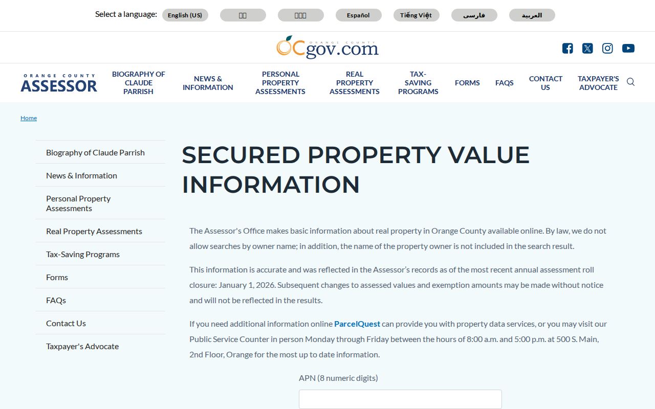
When web fields are suppressed, use the official counter or a lawful request for existing releasable records. Do not ask staff to create a new block roster.
Deeds After the Huntington Beach Parcel Map
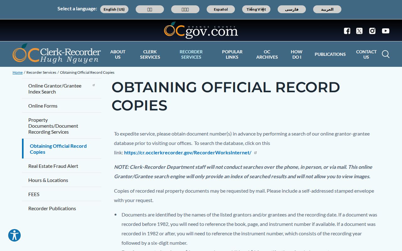
Once each neighboring APN is known, the Orange County Grantor-Grantee index can add recorded-party history. It covers ordinary online searches from 1982 forward, supplies instrument type, recording date, and number, and does not supply document images. It cannot browse an entire street by address, so run one party trail at a time and keep the legal description in view.
For an image, use the county's official copy procedure. Images can be viewed free at three offices. Mailed copies cost $1 per page, with $1 certification per document or map, and the mail address is Orange County Clerk-Recorder, 601 N. Ross Street, Santa Ana, CA 92701. Pre-1982 work needs book, page, and instrument references; later work uses the recording year plus six-digit instrument number.
The official copy procedure image shows the difference between a free index lead and a copy request for the underlying record.
A deed can establish that a party was recorded in an instrument tied to a parcel. It cannot establish that every person at the address was a neighbor at that time.
Huntington Beach Neighbor Block Geography
Huntington Beach neighborhoods do not all make “next door” mean the same thing. The city Property layer supplies spatial context, while annexation and historical sources explain why an older record may use another community label. The area table is a research-routing aid, not a claim that any association has a public member list.
| Area | What Changes the Block Read | Best Public Lead |
|---|---|---|
| Downtown and Old Town | Numbered streets, coastal grid, civic parcels, and older address forms | City parcels, Sanborn maps, directories, and census geography |
| Huntington Harbour | Planned in the early 1960s, with about 620 acres of land, 258 acres of waterway, and 18 miles of waterfront | Parcel geometry, canals, tract maps, and land-record layers |
| Sunset Beach | Annexed August 22, 2011, while retaining a distinct postal and community identity | Annexation layer, MUN field, and exact-address USPS check |
| Surfside | MUN appears in city address data and 90743 is common in USPS addressing, but 90743 is absent from the city ZIP polygon domain | WebAddresses, USPS By Address, parcel and city-boundary layers |
| Bolsa Chica area | Northern parcels and city-edge geography can make postal and municipal labels diverge | 92649 context, parcels, annexations, and land records |
| Goldenwest and Oak View | Tract streets and address points may be more useful than a broad ZIP polygon | City address points, buildings, and parcel geometry |
| Ocean View and Wintersburg | Older community names can survive in historical sources after later city growth | Historical survey, archives, directories, and census variants |
| Southeast Huntington Beach | 92646 approaches Fountain Valley, Costa Mesa, and Newport Beach postal landscapes | USPS, city boundary, and parcel checks together |
| Postwar tract communities | HOA polygons may show spatial coverage without publishing membership names | Property HOA layer and the association's own public contact route |
The research found no verified citywide association roster or current list of HOA memberships. Use the polygon to ask which mapped area contains an address, not to infer which neighbors belong to it.
Huntington Beach Voter and HOA Limits
California's voter channels do not supply a casual block browser. The authenticated lookup requires a first name, last name, full date of birth, and a California identification number or last four Social Security digits, with alternatives for people who lack those identifiers. It returns a registrant's own status, polling details, and ballot information. It has no public name browse, street filter, ZIP filter, wildcard, export, or pagination function.
An Orange County voter-data request is a different process. The 2025 application requires an original wet signature, photo identification, a stated lawful purpose, security measures, and payment. A specific-person request supplies identifying facts and is capped at ten voter records per application. Approved-use and transfer rules apply, and Safe at Home or other protected records may suppress residence information.
The city HOA layer is spatial only. It can help identify whether an address falls within a mapped association area, but the research found no official citywide association directory with membership status. Community groups, congregations, and block-watch rosters remain private unless an organization chooses to publish a contact list.
Myth check. “Public voter data” does not mean an open residents list. Authentication, approved-purpose rules, confidential fields, and protected addresses still control a block search.
Privacy Rules for Huntington Beach Neighbors
Parcel maps reveal land, not household composition. California's Safe at Home program can replace a qualifying participant's address with a substitute mailing address, and voter rules protect home street addresses, phone numbers, email, prior registration information, identification numbers, and signatures in the circumstances defined by law. DMV customer addresses, utility accounts, school-student records, and delivery data are not substitute directories.
Official sources and commercial compilation tools also differ in what they can support. A primary record has a named custodian and a defined access rule. A compiled product may mix uneven public and commercial inputs, repeat stale names, or imply a complete block roster without showing the parcel or record date.
| Source type | Use and limit |
|---|---|
| Official parcel, tax, and deed records | Best for APN, situs, assessment, recorded-party, and date-specific facts; owner identity does not equal presence. |
| Official directories and census | Useful for a dated listed household or subscriber; omissions and historical address changes require cross-checking. |
| Commercial compiled neighbor tools | May combine mixed inputs and stale data; not a replacement for the custodian or a complete block record. |
Lawful use. Huntington Beach neighbor research is appropriate for local history, civic curiosity, reconnection, and proportionate personal safety awareness. Never use parcel or directory information to stalk, harass, intimidate, or harm anyone.
A careful block result ends with clearly labeled facts and clear gaps. It can show which parcels touch, which parties appear in a dated record, and which area layers apply. It should not claim more than those records establish about the people next door.