
How Huntington Beach Streets Become Searchable
A useful Huntington Beach street directory starts with an address, not a person’s name. Normalize the house number, fraction, direction, street name, suffix, unit, and ZIP before searching. Then carry the parcel number and legal description from one custodian to the next. That order matters because an owner, a person listed on a permit, a tax-mail recipient, and a directory subscriber can all be different people. The record trail can show a dated connection to a place, but it should not turn a parcel fact into a claim about every person in a home.
- Resolve the address through Huntington Beach GIS and the Orange County property system. Save the situs address, APN, unit data, ZIP+4, and municipality code when they appear.
- Browse the same street in the city map. Turn on parcels, buildings, land records, ZIP Codes, annexation areas, and HOAs when the block or boundary matters.
- Use voter tools only for the authenticated voter or through the county’s controlled, approved-purpose file process. California does not offer an open name-and-street voter browse.
- Use the Orange County Grantor/Grantee Index for recorded parties and documents. Keep the APN, legal description, instrument number, and recording date with each result.
- For an earlier household, use the reverse or criss-cross shelf at the library or archives, then compare the printed address with census, newspaper, obituary, or probate evidence.
The result is a dated chain of evidence. It can say that a parcel had a recorded transfer, a permit, or a listed subscriber in a named year. It cannot honestly promise a complete current household roster.
Huntington Beach Accela Filters by Address
The Huntington Beach Permit Center is the city’s most direct address-first source for building records, with linked modules for Planning, Engineering, Fire, Urban Runoff, Code Enforcement, and Business Licenses. The building search interface accepts several ways to narrow a result. A known permit number can stand alone. A project name supports the percent sign as a wildcard, so a broad phrase can be tested without guessing the full title.
| Field | Control | Required | Format or use |
|---|---|---|---|
| Search All Records | Text or global search | No | Broad search within the selected module. |
| Permit Number | Text | No | Enter alone when the record number is known. |
| Project Name | Text | No | Use a percent wildcard, such as %keyword%. |
| Start Date / End Date | Date pair | No | MM/DD/YYYY. |
| Permit Type | Dropdown | No | Values load from building record types. |
| Record Status | Dropdown | No | Status choices depend on the selected type. |
| License Type | Dropdown | No | Contractor or license category. |
| State License Number | Text | No | State contractor or license identifier. |
| Street No. | Range or text | No | From and to house-number controls. |
| Frac | Text | No | Fractional address component. |
| Direction | Dropdown | No | Direction choice, with N shown as an example. |
| Street Name | Text | No | Try the name alone when broadening a search. |
| Bldg | Text | No | Building component. |
| Unit | Text | No | Unit component, with 5 shown as an example. |
| Parcel No. | Text | No | Assessor parcel number. |
Results commonly show a record number and type, project or work description, address, status, and dates. Opening a record may reveal workflow milestones, inspections, related records, and named project roles where those details are not withheld. Basic searching is public, while registration or login unlocks applications, payments, inspections, and fuller transaction services. Chrome works best according to the city portal. Safari, Firefox, and mobile browsers may not behave the same way. Records before 1996 use a separate historical link, so a blank modern result is not proof that no permit exists. The permit desk number printed by the city is (714) 536-5511.
Note: A permit is dated evidence of city activity at an address, not a resident register or proof that a named project contact still has a connection to the parcel.
Huntington Beach GIS Address Points
The city address layer adds detail that a plain street list cannot carry. Its GIS entry point leads to map services, while the official WebAddresses service exposes address components for a direct query. That makes it useful for checking whether two spellings describe one point, whether a unit or building number is present, and whether a postal label matches the city’s own municipality field.
The city GIS capture from Huntington Beach GIS shows the parcel and street context to check before a county record search.
The WebAddresses layer records Address_Num, Fraction, Unit, Bldg_Num, street prefix, street name, street suffix, ZipCode, ZIP4, APN when populated, MUN, Address_Type, Mail, StartDate, EndDate, latitude, longitude, and isCondo. MUN can read Huntington Beach, Sunset Beach, or Surfside. The Property service adds Buildings, Parks, Annexation Areas, Land Records, City Owned Property, Zip Codes, HOAs, rights-of-way, wharfs, and beaches. Direct feature responses have a 1,000-record maximum, so a large street or ZIP query must be narrowed or paged.
The data model does not settle occupancy. A residential address type is an address classification. A mailing flag describes address use in the source. Coordinates place a point. An APN joins the point to parcel research. Those are strong keys for the next search, but none is a public list of everyone connected to the address.
Plain Words for Huntington Beach Street Records
Address research gets tangled when a technical term is treated as a person label. A parcel is land. A situs address is the physical location assigned to that land. A plat or map sets out lots, blocks, roads, and other surveyed relationships. A criss-cross directory reverses the usual name-first order and lists a street, number, and listed occupant or subscriber. These meanings keep a street directory useful without making it sound more complete than the source permits.
- Parcel
- An assessed unit of land identified by an APN, with its own tax and map relationship. A parcel can contain more than one unit or structure.
- Situs address
- The physical address of the parcel or building. It is different from the owner’s mailing address when correspondence goes elsewhere.
- Plat
- A recorded land map that shows a tract, lot, block, right-of-way, or parcel geometry used in older deeds and map research.
- Legal description
- The tract, lot, block, survey, or rancho wording that can keep a parcel tied together when a modern number changes.
- Criss-cross directory
- An address-ordered section that can show a printed subscriber or occupant at a street address for the volume’s publication year.
Owner mailing data deserves the same care. It is where a tax notice or other correspondence is sent. It can match the situs for a nearby owner, or point to a trust, business, lender, or distant mailing address. A difference is a research clue, not proof that either address is a person’s home.
Huntington Beach Records by Address
Several local record sets can be reached from an address, but their keepers and limits differ. The coverage below is the practical backbone of a Huntington Beach street directory. It separates map evidence, title evidence, dated city activity, historical listings, and restricted election data so a result is not stretched past what it can prove.
| Record set | Keeper and key | What it can show | Access and limit |
|---|---|---|---|
| WebAddresses | Huntington Beach GIS, street or address fields | Number, unit, ZIP+4, APN, municipality, coordinates, address type | Free service; direct responses capped at 1,000 records |
| Property map layers | Huntington Beach GIS, map click and layer query | Parcels, buildings, annexations, HOAs, ZIPs, land records, city property | Free map context; not an owner-name roll |
| Secured value screen | Orange County Assessor, eight-digit APN | Basic annual-roll parcel, value, and exemption information | Owner name omitted online; counter at 500 S. Main St., Orange |
| Tax-bill search | Orange County Treasurer-Tax Collector, address or APN | Situs, owner-of-record tax context, bills, payments, levies | Up to 15 years of bill copies and two years of payment detail announced |
| RecorderWorks index | Orange County Clerk-Recorder, party and date | Grantor, grantee, instrument, document type, recording date, maps | Free index; ordinary web images unavailable; copies cost $1 per page plus $1 certification |
| Accela permit records | City Permit Center, street parts or APN | Project, permit type, status, dates, inspections, named project roles | Public search; pre-1996 records follow a separate path |
| Reverse directories | Library, OCCGS, Archives, street and number | Listed subscribers or occupants for a printed year | Years and shelf runs vary; “No listings” is not proof of vacancy |
| Voter records | Orange County Registrar, authenticated or approved file request | Own registration status, or approved file fields and voting history | No open street browse; Elections Code restrictions apply |
The county’s secured property-tax address search is a useful bridge from a street to a parcel and its tax record. The capture shows that address-led starting point.
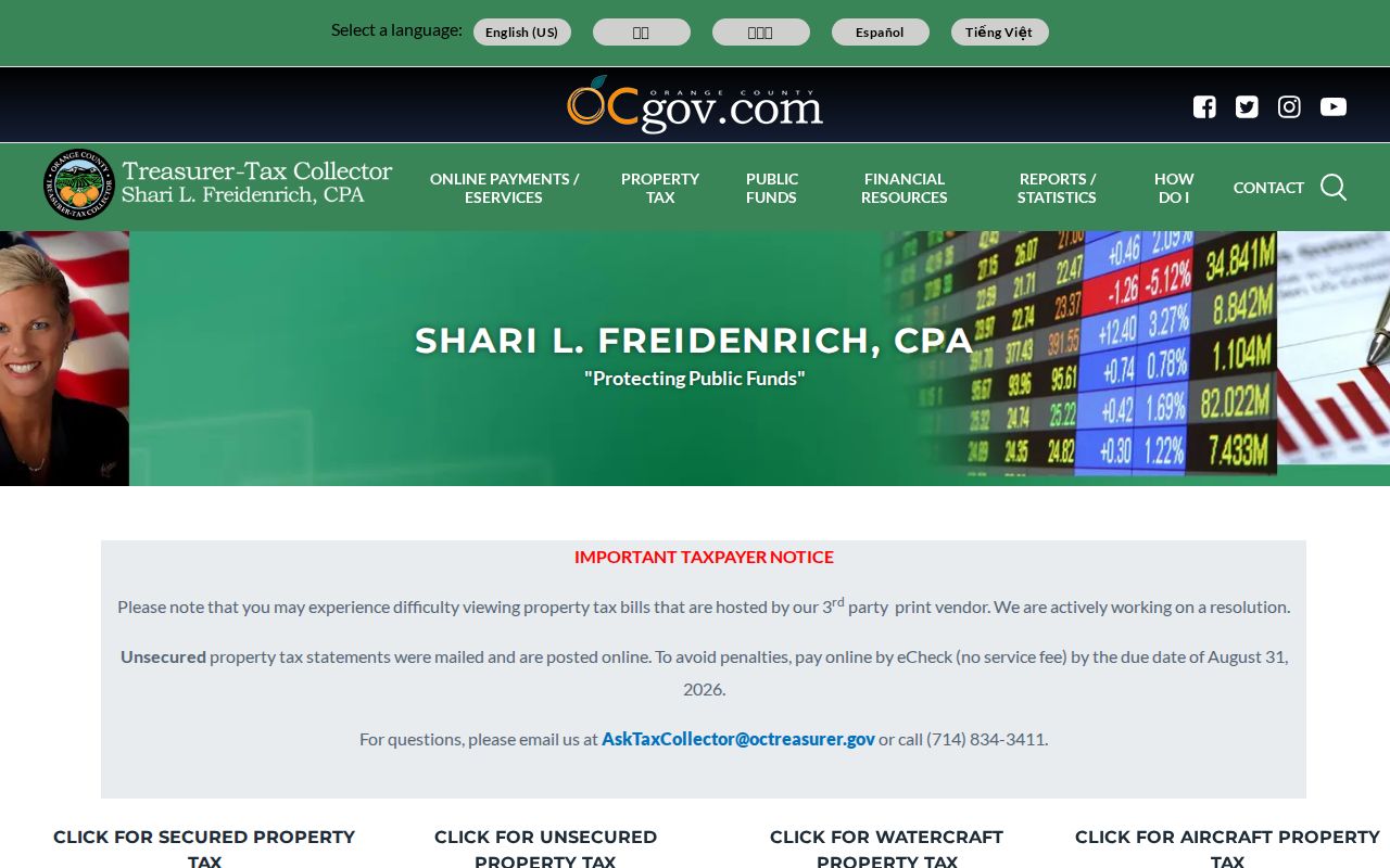
After the tax or map step, keep the physical situs and the mailing destination in separate notes. The tax bill can carry owner-of-record facts as of the lien date, but a tax record still does not list every person present at the parcel.
Note: A street-by-street result is strongest when an address point, APN, dated instrument, and independent historical listing agree without collapsing their different roles.
Huntington Beach APN Deed History
The Orange County recorder index is party-based, not a simple whole-street browse. An APN and legal description therefore do the joining work. Start with the parcel, find a current acquisition instrument or a reliable recording reference, and then move from the grantee on that deed to the earlier grantor. The process is slower than a name-only search, but it keeps two people with the same name from being merged by guesswork.
The county’s Land Insights map can help preserve parcel, tract, survey, annexation, and document context before a deed search. Its map is geographic evidence, not the deed itself.
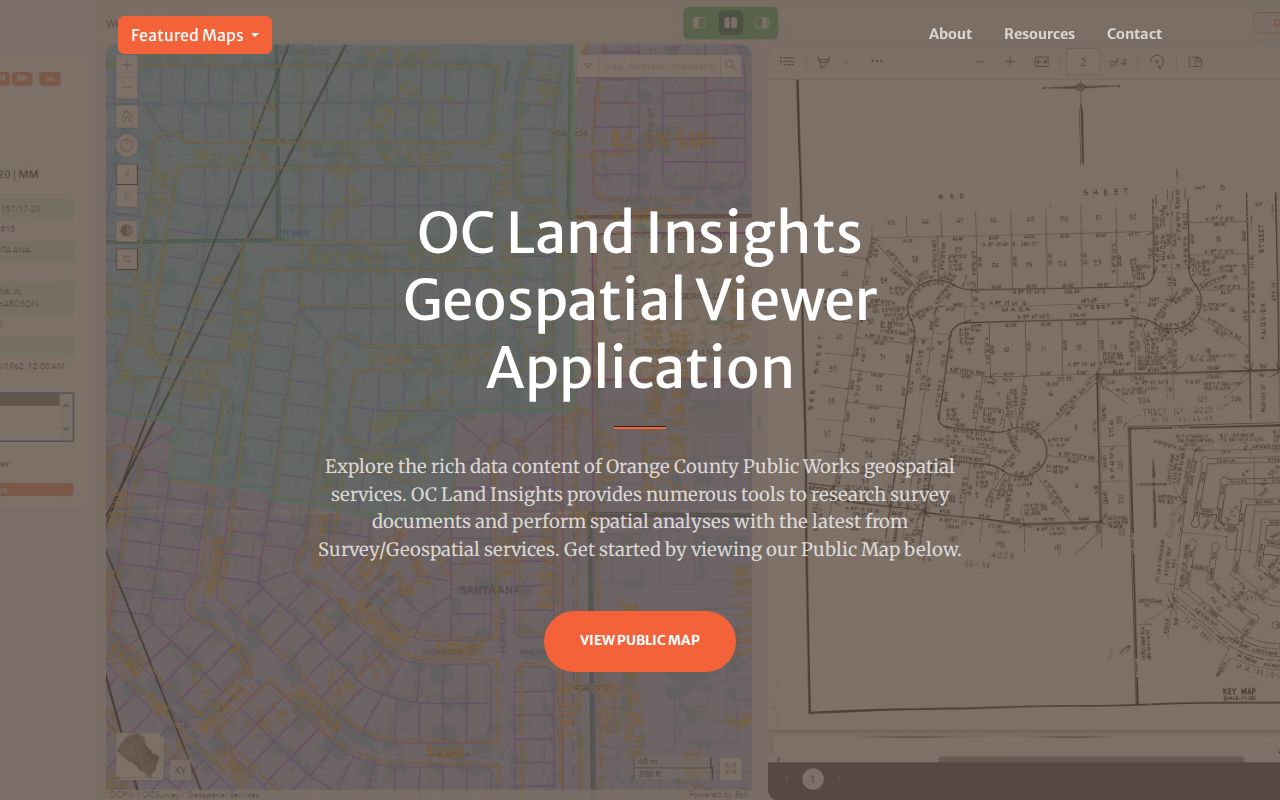
The image connects the street question to the county land-record layer. Read the actual instrument before assigning a person a role, because a deed of trust, reconveyance, quitclaim, easement, lien, or notice does not mean the same thing as a sale.
- Save the APN, tract or lot, legal description, and situs address from the map or parcel sources.
- Search the present party in RecorderWorks by name and narrow by recording date. The portal accepts a person or business name in LAST FIRST order and supports partial matching.
- Capture the grantor, grantee, document type, recording date, and instrument number from the index. The web result is an index, not a home image.
- Search the earlier seller as a grantee. Confirm the legal description or APN on the underlying instrument before continuing backward.
- For 1982-forward copies, use the recording year plus six-digit instrument number. For pre-1982 work, book, page, and instrument references support the older book and fiche route.
- Order a copy from the Clerk-Recorder at 601 N. Ross Street, Santa Ana, CA 92701 with a check, a self-addressed stamped envelope, and the needed reference. Copies cost $1 per page, and certification adds $1 per document or map. Images may be viewed free at three office locations.
- When the online chain reaches an older gap, use the documented Archives and index-book fallback. Orange County preserves 640 deed volumes from 1889-1926 and 210 property-index volumes from 1889-1953. Before 1889, search predecessor Los Angeles County and rancho-era sources.
RecorderWorks staff do not perform the underlying search by phone, mail, or at the counter. The free index is the place to obtain a reference; the office then supplies the copy through its stated process. A current deed establishes a recorded title party on a date. It does not establish every current resident.
Permit Dates Along Huntington Beach Streets
Permit records add a different kind of street evidence. They can show when a building project, addition, demolition, inspection, code case, or business-license record was created, and they may name an owner, applicant, architect, contractor, or other project role as it appeared at filing. Those roles should remain labeled. A person attached to a permit is not automatically the owner or resident at the time of the search.
The city’s WebLink repository adds dated agendas, staff reports, planning files, minutes, and correspondence. The Huntington Beach City Clerk is the routing point for city-created records not already posted. A public packet may preserve an address, applicant, owner, representative, or speaker. It is dated evidence of participation or a city decision, not a current residence list. Current privacy practice may limit personal details in newer files.
When a needed file is not online, describe an existing record to the City Clerk or Community Development office by date range, address or APN, permit or project number, department, and desired format. Under California Government Code §7922.535, an agency generally makes an initial determination within 10 calendar days and may extend that determination by 14 days in unusual circumstances. That is a response deadline, not a promise that production will happen on the same day. The CPRA does not require staff to create a new street list from separate systems.
Note: City files can preserve a person’s dated role in a public project while still withholding protected names, complainant details, plans, or investigative material.
Huntington Beach Streets, Annexations, and Postal Names
A street directory can fail when a modern city name is applied to an older record without checking jurisdiction. Huntington Beach incorporated in 1909, while later annexations expanded the city through areas that had earlier county or rural records. The GIS Annexation Areas layer identifies dates and names for 1909, 1945, 1966-68, 1970, 1971, 1972, 1974, 1981, 2000, 2002, 2007, and 2011. For a historic parcel, the relevant city department may not have created the record at the time in question.
Sunset Beach was annexed on August 22, 2011, yet it retains a distinct community and postal identity. The address layer codes Huntington Beach, Sunset Beach, and Surfside as separate municipality values. The city ZIP layer includes 90742 beside 92646, 92647, 92648, and 92649. Surfside commonly uses 90743, but 90743 is not one of those five city ZIP polygon values. An exact address should be checked through USPS and then through the city parcel and jurisdiction layers.
No verified citywide street-renumbering year was found. When an old number appears not to match a new one, compare the legal description, APN, annexation map, historic map, permit, directory, and deed parties. The continuity key is the land description, not a ZIP or a guessed number change. The mismatch between postal city, municipal area, and parcel situs is a useful local clue, not a nuisance to erase.
Criss-Cross Directories for Huntington Beach Streets
Older reverse material supplies the street side of a Huntington Beach city directory. The confirmed anchors are a 1941 regional volume covering Santa Ana, Orange, Huntington Beach, Balboa Island, Newport Beach, and Costa Mesa; a 1951 Huntington Beach city directory indexed online; Pacific Telephone issues from March 1935 through December 1948, November 1955 through November 1958, and individual November issues for 1959, 1960, and 1961; and modern address abstracts for 2010, 2014, 2017, and 2022 described in a 2025 city-filed environmental report.
The historical shelf has a real research gap. No authoritative catalog located an exhaustive publisher-by-publisher run, call number, or last printed year for Huntington Beach criss-cross volumes. The Huntington Beach city directory collections page is the natural place to separate confirmed years from that gap. For a specific address, ask the OCCGS Genealogy Center or Orange County Archives to identify the volume before treating a missing year as a missing household.
- Search the alphabetical section for a surname, given name, spouse, occupation or printed address.
- Turn to the street-order section and search the house number, street, nearby entries, and adjoining addresses.
- Copy the volume’s abbreviation key before interpreting marks for residence, boarding, ownership, or marital status.
- Compare a “No listings” result with the next and prior issues, permits, deeds, census schedules, and newspapers.
A printed listing proves that the publication carried a name or subscriber at an address for that edition. It can miss unlisted numbers, omit members of a household, use a delayed address, or describe a business rather than a home. That modest claim is still valuable for tracing a block across time.
When Huntington Beach Street Search Fails
Begin by checking the input, not by deciding that the record does not exist. Remove a street suffix to broaden an Accela search. Try the percent wildcard in Project Name. Test the APN instead of a name. Add or remove a direction, fraction, unit, or building number. For a RecorderWorks search, use the portal’s LAST FIRST format and narrow the date range. For an older permit, follow the pre-1996 link rather than repeating the modern search.
A blank assessor web result is expected when the query asks for an owner name. The county-hosted secured-value screen takes a required eight-digit APN and does not provide an owner-name or street-address field. Revenue and Taxation Code §408 governs inspection of assessor records. Use the Assessor’s Public Service Counter at 500 S. Main Street, 2nd Floor, Orange, Monday through Friday, 8:00 a.m. to 5:00 p.m., when existing assessment information must be checked through the official counter.
For older deeds, use book, page, instrument, index-book, or fiche references. Recorder copy questions can be directed to (714) 834-2500, but staff do not conduct the underlying search. For historical people records, ask the library or Archives about exact holdings. For a city-created document, make a focused CPRA request for an existing file. Each fallback changes the search key or keeper. A no-hit means “not found in this index with these inputs on this date,” not “the person or parcel never existed.”
Note: The strongest street answer records the search date, source, field values, coverage cutoff, and the reason a result was treated as a lead rather than proof.
Huntington Beach Street Directory Limits
Parcel and deed records describe land and recorded parties. Permits describe city activity. Reverse directories describe printed listings. None is a full household roll. Children, roommates, unlisted subscribers, visitors, and many household members may never appear. A tax mailing address can point to a trust, business, lender, or distant owner. A recorded owner can be away. The difference between these categories is the central privacy limit in any Huntington Beach street directory.
California voter data is also not an open street browser. The authenticated voter tool asks for a registrant’s name, date of birth, California driver license or ID details or the last four Social Security digits, and a first-name prefix. Full voter-file access is controlled under Elections Code §§2188, 2194, and 18109, Government Code §7924.000, and 2 CCR §§19001-19013. DMV personal information is protected by the federal Driver’s Privacy Protection Act, and utility customer records are not a substitute address directory.
Lawful use. Huntington Beach street and address records support personal, lawful research, family history, property curiosity, and civic review. Do not use a name, address, map, or record to stalk, harass, threaten, intimidate, or harm another person, and do not try to defeat a confidentiality protection.
Safe at Home can replace a qualifying participant’s public address with a substitute mailing route, and court, vital, voter, law-enforcement, and confidential files can omit or restrict fields. A protected gap is a legal boundary, not an invitation to reconstruct the hidden detail from another source.